Walking through Berlin today, it’s easy to miss the profound scars left by its past. But armed with a detailed berlin wall map, the invisible suddenly snaps into sharp focus, transforming a modern cityscape into a living museum of division, resilience, and ultimate freedom. This isn’t just about tracing a line on paper; it’s about understanding the complex military system that once choked a city, the human stories etched into its path, and the enduring lessons of the Cold War.
At a Glance: Navigating Berlin’s Divided Past with a Map
- Uncover the Wall’s True Form: See beyond a simple barrier to understand the “death strip” and its intricate defenses.
- Locate Key Remnants: Pinpoint preserved sections, memorials, and invisible historical markers.
- Strategic Route Planning: Optimize your visit to major sites like the East Side Gallery, Bernauer Strasse, and Checkpoint Charlie.
- Choose Your Navigation Tool: Understand the benefits of digital apps versus traditional physical maps for different exploration styles.
- Decipher Historical Layers: Use a map to connect physical locations to powerful stories of escape and oppression.
- Embark on the Berlin Wall Trail: Plan your journey along the 155km former border, whether walking or cycling.
More Than a Line: The Berlin Wall’s True Physicality
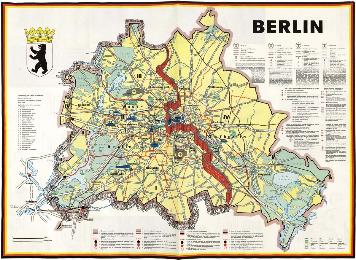
When we talk about the Berlin Wall, many picture a single, imposing concrete slab. But a true berlin wall map immediately corrects this misconception, revealing a far more sinister and complex reality. Erected almost overnight between August 12-13, 1961, by the German Democratic Republic (GDR), it was initially a simple barbed-wire fence, but quickly evolved into an impenetrable fortress designed to halt the mass exodus from East Germany.
This wasn’t just a wall; it was two parallel concrete walls, roughly 12 feet (3.6 meters) high, separated by a desolate expanse known as the “death strip.” Maps from the Cold War era vividly illustrate this multi-layered barrier: floodlights, watch paths, alarm systems, anti-vehicle trenches, barbed wire, and signal fencing. At its peak, this 155-kilometer (96-mile) ring around West Berlin bristled with over 300 watchtowers and was patrolled by 14,000 guards and 600 dogs. A specialized map doesn’t just show a border; it details a deadly, engineered landscape of control.
Mapping the Ghost: Tracing the Wall’s Disappearance and Remains
The Berlin Wall famously fell on November 9, 1989. While much of it was dismantled, its impact and physical scars are still deeply woven into Berlin’s urban fabric. A good berlin wall map is essential for differentiating between preserved segments, memorial sites, and the often subtle outlines of where the Wall once stood.
For instance, the East Side Gallery isn’t just a wall; it’s a 1.3 km section of the original inner wall, transformed into the world’s longest open-air gallery with over 100 murals by international artists. Your map will show this vibrant stretch along the Spree River, guiding you through its artistic and historical significance. Similarly, the Berlin Wall Memorial (Gedenkstätte Berliner Mauer) at Bernauer Strasse offers a different, starker experience. Here, maps guide you through a preserved section of the original wall, a guard tower, and a chilling stretch of the “death strip,” allowing you to physically comprehend its scale and terror.
Beyond these major sites, a detailed map helps you find the less obvious markers. Look for a double row of cobblestones embedded in the street that traces the Wall’s former path, snaking through neighborhoods, parks, and even modern developments. Places like Potsdamer Platz, once a desolate no-man’s land, are now bustling hubs, yet maps highlight where the Wall dissected them, connecting the past desolation with present vibrancy. You’ll also find preserved sections at Mühlenstrasse and the remnants of the border crossing at Friedrichstrasse Station, now housing a museum that tells powerful escape stories.
Your Navigation Toolkit: Choosing the Right Berlin Wall Map
To truly unlock Berlin’s Cold War history, selecting the right berlin wall map for your exploration style is key.
Digital Apps & Interactive Maps
For many contemporary explorers, digital solutions are paramount. GPS-enabled apps and interactive online maps offer real-time navigation along the former Wall’s route, like the comprehensive Berlin Wall Trail. Many also integrate augmented reality features, allowing you to overlay historical photographs onto current street views, vividly illustrating what once stood there. They provide instant access to historical information, photos, and even audio guides for specific locations, turning your smartphone into a personal historian. Public transport routes are often seamlessly integrated, making it easy to hop between sites.
Physical Maps & Guidebooks
Despite the digital age, a high-quality physical berlin wall map or specialized guidebook remains invaluable. These often provide a broader overview of the city, excellent historical context, and detailed explanations that can be harder to absorb from a small screen. They don’t rely on battery life or data, making them reliable companions for a full day of exploration. Specialized maps might highlight specific themes, like escape routes or significant Cold War events, providing a focused historical lens.
- Decision Point: Use a physical map for initial planning and a bird’s-eye view of your itinerary. Then, switch to a digital map or app for on-the-ground navigation, public transport details, and immediate access to site-specific information. This hybrid approach often provides the best of both worlds.
For a deeper dive into the routes and locations, it’s worth taking time to Explore Berlin Wall route map, which can serve as a foundational guide for your exploration.
The Berlin Wall Trail Map
If you’re aiming for a truly immersive experience, the Berlin Wall Trail (Berliner Mauerweg) is a must. This 155-kilometer route traces the Wall’s exact path, ideal for walking or cycling. A dedicated berlin wall map for this trail is crucial. It highlights the entire circuit, breaking it down into manageable sections, indicating access points, public transport connections, and marking every significant memorial, information board, and remaining segment of the Wall. These maps are designed for endurance, often including information on amenities like cafes, restrooms, and bike repair shops along the way.
Strategic Exploration: Planning Your Berlin Wall Route with a Map
Effective planning with a berlin wall map transforms a simple sightseeing trip into a profound historical journey.
- Identify Your “Must-See” Sites: Start by marking the major landmarks. Most visitors prioritize the East Side Gallery for its art, the Berlin Wall Memorial at Bernauer Strasse for its profound historical preservation, and Checkpoint Charlie for its iconic Cold War border crossing status.
- Connect the Dots Logically: Don’t hop randomly. Use your map to plot an efficient route. For instance, you might start at Bernauer Strasse, take the U-Bahn or tram south to Friedrichstrasse Station, then continue towards Checkpoint Charlie, perhaps finishing at the East Side Gallery. Your map will show public transport lines (U-Bahn, S-Bahn, tram, bus) that make these connections seamless.
- Understand the “Death Strip”: At Bernauer Strasse, maps don’t just show a line; they illustrate the width of the “death strip.” This visual understanding helps contextualize the desperation of those who attempted to cross. Walk along the strip on the map and then in person to truly grasp its formidable nature.
- Discover Beyond the Famous: A good map also points you to lesser-known but equally significant spots. Consider the Glienicke Bridge, where Cold War spy exchanges took place, or sections near Nordbahnhof, one of Berlin’s “ghost stations” where trains from West Berlin passed through the silent East without stopping. These sites add layers of depth to your understanding.
- Avoid Common Pitfalls: Without a map, it’s easy to underestimate distances or over-schedule. Berlin is vast, and while the Wall’s remnants are concentrated in some areas, they also stretch far. Maps help manage your time and expectations, allowing for meaningful reflection rather than rushed transit.
Map-Guided Stories: Unearthing Personal Narratives
The true power of a berlin wall map isn’t just in its lines and labels; it’s in its ability to anchor countless human stories of division, courage, and sorrow to specific locations. These maps become portals to the past.
Imagine tracing the route of Tunnel 57 (1964), where students dug a tunnel under the Wall, helping 57 East Berliners escape to freedom. Your map would pinpoint the starting point in a bakery basement and the thrilling emergence on the other side. Or visualize the daring flying escape in 1979, where two families used a homemade hot air balloon. While maps can’t show air currents, they can show the launch point and the ultimate landing, providing a geographical context for this extraordinary feat.
Maps also highlight how entire neighborhoods were bisected, separating families and friends overnight. Streets like Bernauer Strasse saw residents literally jumping from apartment windows in the East to freedom in the West as the Wall went up. By following these geographical divisions on your map, you gain a deeper empathy for the daily realities of life in a divided city and the incredible human spirit that defied it.
Practical Playbook: Implementing Your Berlin Wall Map Strategy
Ready to explore? Here’s a quick guide to making the most of your berlin wall map:
- Define Your Focus: Are you interested in art, historical facts, personal stories, or an active exploration like cycling the entire trail? Your focus will dictate which map type and areas you prioritize.
- Select Your Map Arsenal: Purchase a detailed physical map (like a Baedeker or official Berlin Wall Trail map) for strategic overview. Complement this with a reliable digital app (e.g., Google Maps, specialized historical apps) for live navigation, transit info, and on-the-spot historical details.
- Pinpoint Core Sites: Mark the East Side Gallery, Berlin Wall Memorial at Bernauer Strasse, and Checkpoint Charlie. These are non-negotiable for a first-time visitor.
- Chart Logical Connections: Use public transport lines on your map to create a smooth itinerary between your marked sites. Consider grouping nearby locations to minimize travel time (e.g., Bernauer Strasse and Nordbahnhof).
- Budget Your Time: Don’t just look at distances; factor in time for contemplation at memorials, reading information panels, and navigating through crowds. A map helps you visualize stops and allocate realistic time.
- Look for the Subtle Markers: Keep an eye out for the double row of cobblestones that traces the Wall’s former path. Your map will show where these “invisible” markers should appear.
- Layer Personal Stories: Before visiting a site, read up on a specific escape or event tied to that location. Then, use your map to physically trace the narrative, making the history much more tangible.
Quick Answers: Common Questions about Berlin Wall Maps
Q: Is one berlin wall map enough for everything?
A: Not necessarily. While a comprehensive city map might show major Wall remnants, a dedicated berlin wall map or specialized Wall Trail map offers far greater detail, historical context, and specific route guidance that standard tourist maps lack. A combination is often best.
Q: Are physical maps still relevant in the age of apps?
A: Absolutely. Physical maps provide a crucial broad overview, don’t suffer from battery drain, and are excellent for initial planning and understanding the overall geography without digital distractions. They complement, rather than replace, digital tools.
Q: How accurate are modern maps in showing the Wall’s exact route?
A: Highly accurate. Modern berlin wall map resources, especially those from official city tourism bodies or historical foundations, meticulously trace the Wall’s original path, often based on historical documents and aerial photographs. The embedded cobblestone lines are a testament to this precision.
Q: Can I cycle the entire Berlin Wall Trail with a standard city map?
A: You could, but it wouldn’t be ideal. A standard city map lacks the specific detail, directional cues, and information about amenities (like water stops or historical markers) that a dedicated Berlin Wall Trail map provides, which is crucial for a 155km journey.
Q: What’s the biggest misconception people have when using a berlin wall map?
A: The biggest misconception is often expecting to see a continuous, fully preserved Wall. Maps clarify that while segments remain, much of it is now marked by subtle lines, memorial plaques, or integrated into modern structures. The map guides you to both the visible and invisible remnants.
Beyond the Concrete: Your Map to a Deeper Understanding
A berlin wall map is far more than a navigation tool; it’s a key to unlocking one of the most significant periods in modern history. It allows you to walk through a city that was physically and ideologically cleaved in two, to stand where lives were irrevocably altered, and to trace the very path of freedom’s eventual triumph. By using these maps, you don’t just visit Berlin; you deeply experience its past, making the echoes of division and the spirit of resilience resonate long after you’ve left.


