Ever wondered why navigating some modern cities feels intuitively right, or how ancient metropolises sustained millions without advanced technology? The answer lies rooted in Ancient Rome’s sophisticated urban planning. Far from accidental growth, Roman cities were meticulously engineered marvels, designed for efficiency, defense, and vibrant civic life. From the sacred boundary lines that dictated expansion to the groundbreaking aqueducts that delivered life-sustaining water, the Romans laid down principles that continue to resonate in contemporary urban development. This deep dive into Roman city layout reveals not just historical achievements, but timeless lessons for building resilient, functional, and socially cohesive urban environments—a true blueprint for today’s cities. For an overview, consider exploring Roman planning.
Ancient Rome’s Master Plan: Engineering a Civilization
Roman urban design, a compelling fusion of military strategy, pragmatic functionality, and an emerging appreciation for aesthetic harmony, evolved from rudimentary walled settlements into complex, highly organized cities. This profound transformation hinged on a groundbreaking grid system, innovative infrastructure, and nuanced zoning practices that fundamentally shaped how we conceptualize and construct urban spaces in the modern era.
Key Insights into Roman Urbanism:
- Roman city planning established foundational principles for contemporary urban design, emphasizing systematic grid layouts, advanced infrastructure, and strategically integrated public spaces.
- While functionality and order were paramount, Roman cities also meticulously prioritized social cohesion, public health, and an undeniable aesthetic appeal for all inhabitants.
- The enduring impact of their grid-based organization, infrastructural innovations, and thoughtful integration of public amenities continues to profoundly influence urban planning principles across the globe.
The Sacred Boundaries and Strategic Defenses of Early Rome
The distinctive topography of Rome, characterized by its renowned seven hills and the meandering Tiber River, profoundly influenced the city’s nascent development. In its genesis, Rome was carefully delineated by a sacred boundary known as the pomerium, a ritualistic furrow that symbolically marked its spiritual and political limits. This consecrated zone, often designated by sacred stones called cippi, strictly prohibited activities such as burial and the carrying of weapons, thereby physically separating the urban core (urbs) from its rural territory (ager), and delineating religious duties (domi) from military authority (militiae). As the city’s population swelled and its political influence expanded, the pomerium was ceremonially extended, reflecting Rome’s growing dominion.
The imperative for defense simultaneously drove the construction of formidable protective walls. Early earthen fortifications gave way to more robust structures following the Gallic invasion of 393 BCE, prompting the construction of the Servian Walls, and later, the mighty Aurelian Walls in 270 CE. The Aurelian Wall, stretching nearly 18.8 kilometers (11.7 miles) and encompassing roughly 14 square kilometers, often incorporated existing buildings—even amphitheaters—into its structure in a testament to the urgency of its construction. These monumental walls not only shielded the burgeoning metropolis from external threats but also profoundly shaped its physical expansion and internal organization, defining distinct areas within and beyond its perimeter.
The Roman Grid System: Precision and Purpose in Urban Design
A defining and exceptionally impactful characteristic of numerous Roman cities was their meticulous grid system. Visualize a city where every street intersected at precise right angles, forming a logical and highly efficient pattern. This organized grid was typically structured around two primary thoroughfares: the cardo maximus (the principal north-south road) and the decumanus maximus (the primary east-west road). These two vital arteries converged at the forum, which served as the city’s dynamic nucleus—a bustling center for political discourse, vibrant social gatherings, and vigorous trade.
The implementation of this structured grid system drastically simplified urban organization. It systematically divided the city into manageable rectangular blocks, known as insulae (city blocks), between which were housed insulae (multi-story apartment buildings for common citizens) and domus (spacious private homes for affluent families). This organized layout facilitated intuitive navigation, streamlined the efficient flow of goods and services, and enabled a more equitable distribution of essential resources, significantly enhancing overall urban efficiency for its rapidly expanding populace. While the cardo and decumanus were common, Roman city planning was not monolithic. Variations existed, such as cities laid out per scamna (where blocks were elongated rectangles with the long side parallel to the decumanus) or per strigas (where blocks had their long side perpendicular to the main axes), adapting to terrain or existing settlements, as seen in examples like Norba or Cosa.
Engineering Life: Revolutionary Water and Sanitation Systems
To sustain its burgeoning population—which Pliny the Elder estimated at well over 1,500,000 in his time (Natural History III.v.66-67)—ancient Rome developed remarkably advanced and extensive infrastructure. Elaborate aqueducts (Aqua Appia, Anio Vetus, Marcia, Tepula, Julia, Virgo, Alsietina, Claudia, Anio Novus, Traiana, Alexandrina; totaling eleven major conduits at their peak) precisely channeled fresh, clean water from distant sources directly into the city, ensuring a consistent and copious supply. Pliny the Elder lauded these systems, noting that “rivers may be said to flow through the city and the sewers, and almost every house is furnished with water pipes and copious fountains” (Natural History XXXVI.xxiv.101-110). These aqueducts, built primarily of masonry to avoid the expense of lead or the non-existence of cast iron, often followed gentle slopes, using tunnels and bridges (like the stunning Pont du Gard) to maintain gradient rather than siphons.
Concurrently, the Cloaca Maxima (the “Greatest Sewer”), a massive and pioneering sewer system constructed as early as the reign of Tarquinius Priscus (700 years before Pliny’s time), effectively channeled waste away from urban areas. Pliny described these “seven rivers” beneath the city, noting their remarkable durability against collapses, fires, and even earthquakes. The widespread availability of public baths (ranging from small balnea to grand thermae like the Baths of Caracalla, offering libraries, gardens, and gymnasiums) and numerous public fountains underscored the paramount importance of sophisticated water management and civic hygiene in Roman society. This robust infrastructure was indispensable for maintaining public health, supporting vigorous economic activity through various industries, and ensuring the enduring prosperity of the city’s many inhabitants. Without these meticulously engineered systems, Rome’s immense growth and unparalleled prosperity would have been severely constrained.
The Urban Fabric: Navigating Life in Ancient Rome
Despite the grandeur of its public works, daily life in ancient Rome presented both convenience and considerable challenges, profoundly shaped by its urban layout.
Housing and Social Dynamics:
Roman cities displayed a unique social tapestry where “high and low, patrician and plebeian, rubbed shoulders everywhere.” Unlike later segregations, wealthy Romans often lived in domus (single-family city homes) adjacent to insulae (multi-story apartment blocks), which housed the majority of Rome’s population. These insulae could be surprisingly tall—Emperor Augustus decreed new buildings along public ways should not exceed seventy feet in height due to frequent collapses and fires. The ground floors of insulae frequently housed tabernae (shops or workshops) that opened directly onto the street, often with a small loft above for the shopkeeper’s family, leading to crowded and often precarious living conditions.
Streets: A Confounding Labyrinth:
The streets of Imperial Rome were often a “tangled net,” dark at night, and notoriously filthy. Tacitus attributed the rapid spread of the Great Fire of 64 A.D. to the “anarchy of these confined streets, winding and twisting as if they had been drawn haphazard between the masses of giant insulae.” Juvenal’s satires vividly portray a city where one had to “walk right through the mud” and going out at night without a will was “carelessness.” Street widths varied greatly: true viae (main roads for two carts) like the Via Sacra and Via Nova were surprisingly few, while most were narrow vici or even narrower angiportus (passages) or semitae (footpaths), barely wide enough for projecting balconies. Despite Caesar’s decrees for landlords to clean streets and aediles to enforce it, effective waste management in practice often lagged. Domitian’s edict forbidding the display of wares on the street improved pedestrian passage, but the streets remained challenging.
Public Safety and Crime:
At night, without public lighting, Rome’s streets plunged into “impenetrable darkness.” Wealthy citizens required torch-bearing slaves for protection, while others relied on lightly effective night watchmen (sebaciarii). The Digest of Roman law details the abundance of “murderers (sicarii), housebreakers (effractores), [and] footpads (raptores)” that made night travel perilous, underscoring the stark contrast between Rome’s monumental public facade and the often-harsh realities of daily existence.
Public Spaces: The Beating Heart of Roman Community Life
The Romans possessed a profound understanding of the significance of community life, a philosophy clearly manifested in the meticulous design and integration of their public spaces. The forum, located at the intersection of the cardo and decumanus, was unequivocally the vibrant hub of civic life—a dynamic public square that simultaneously functioned as a bustling market, a vital courthouse, and an essential meeting place for citizens. Basilicas, temples, and curiae (senate houses) flanked these central spaces, making them crucibles of political decision-making, legal proceedings, and religious observance.
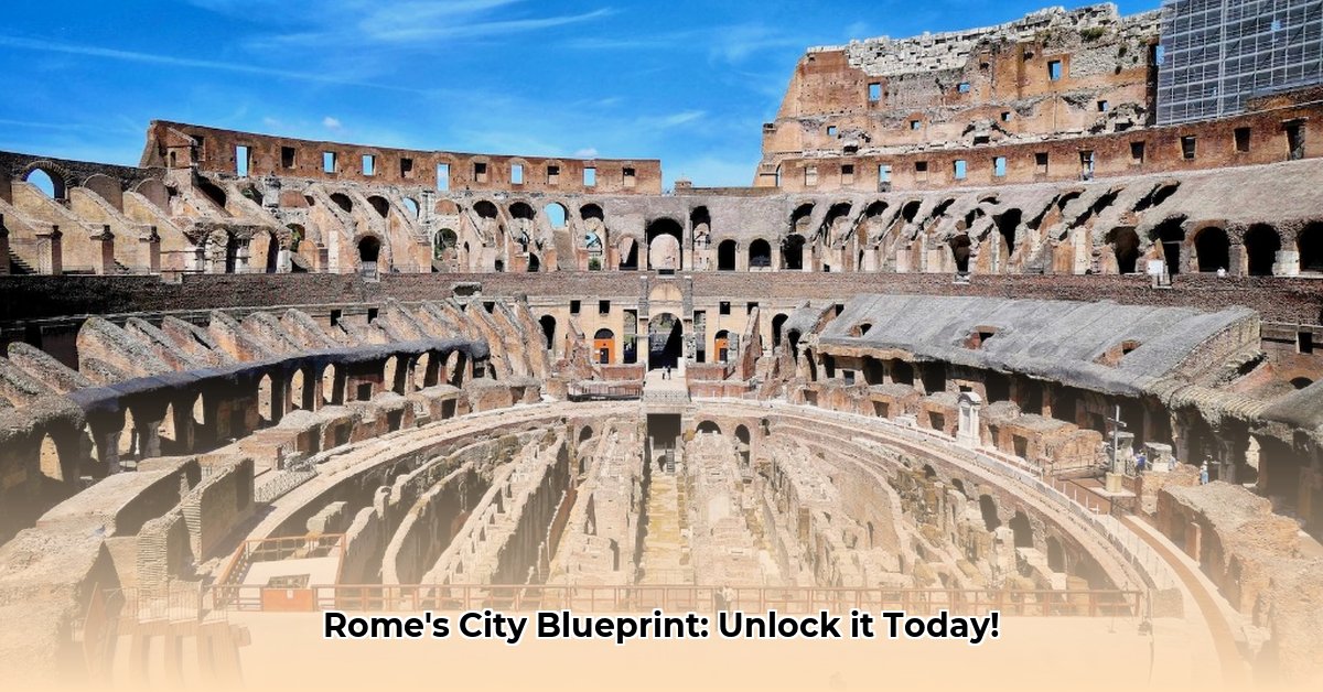
Other equally important public spaces included the widespread public bathhouses, grand amphitheaters (like the iconic Colosseum), and elaborate theaters. These areas were strategically positioned and meticulously designed to efficiently serve the diverse needs of the populace, providing abundant opportunities for both leisure and essential social interaction. Public baths, in particular, were not merely places for hygiene but comprehensive cultural centers with libraries, gardens, and gymnasiums. This harmonious blend of order, practicality, and undeniable aesthetic appeal cemented Roman cities as quintessential models of urban design for centuries.
A Lasting Legacy: Roman Urban Planning Today
The profound and multifaceted impact of Roman urban planning continues to be conspicuously evident in cities across the globe today. The widespread adoption of grid layouts, the establishment of sophisticated zoning regulations (though more formalized now), and the creation of extensive public parks and squares can all trace their conceptual origins back to Roman precedents. Furthermore, Roman construction techniques, notably their revolutionary use of hydraulic concrete (pozzolana) and the structural elegance of the arch, have profoundly influenced subsequent architectural innovation and civil engineering for millennia. The Pantheon’s massive unreinforced concrete dome, standing intact after nearly two millennia, serves as a monumental testament to this enduring genius.
Insights gleaned from the Severan Marble Plan, an immense 18-meter by 13-meter marble map of Rome commissioned between 203-211 CE, continue to illuminate details of the city’s intricate layout, including lost landmarks like the Dacian Gladiatorial Training School and the Severan Septizodium. This map underscores the Roman commitment to comprehensive urban documentation and planning. The Roman example compellingly suggests that these early urban innovations continue to significantly shape how we construct and organize our contemporary urban spaces, providing a timeless blueprint for livability and resilience.
How can we effectively apply ancient Roman city layout principles in today’s urban development? Consider the following actionable insights:
| Stakeholders | Short-Term (0-1 Year) | Long-Term (3-5 Years) |
|---|---|---|
| Urban Planners | Study Roman grid systems and adaptive zoning principles for efficient, navigable city design. | Integrate sustainable water management and sanitation solutions, drawing from Roman aqueduct and sewer models, and promoting mixed-use zoning. |
| Civil Engineers | Research Roman concrete and arch techniques for developing more durable, low-carbon, and sustainable construction materials. | Implement gravity-fed water systems where feasible to conserve energy, reduce operational costs, and enhance system resilience. |
| Architects | Apply Roman principles of aesthetic balance, proportionality, and integrated public amenities in modern building and urban designs. | Develop designs that foster seamless transitions between private and public spaces, mirroring the Roman integration of forums and baths. |
| Policy Makers | Implement policies promoting vibrant, accessible public spaces and community centers, inspired by the social function of Roman forums. | Invest in preserving and promoting historical urban planning sites for cultural heritage, educational value, and sustainable tourism. |
| Public Health Officials | Advocate for robust sanitation infrastructure and clean water access as core urban planning priorities, echoing Roman public health focus. | Develop comprehensive urban hygiene strategies, leveraging lessons from Roman waste management and public bath systems for contemporary challenges. |
| Historians/Archaeologists | Conduct further interdisciplinary research into Roman urban labor practices, social stratification within urban layouts, and comparative city plans. | Develop educational curricula and public outreach programs highlighting Roman urban planning’s enduring influence and practical lessons for modern society. |
By meticulously studying and judiciously adapting these timeless principles, we can effectively learn from the past to create more livable, ecologically sustainable, and vibrant cities for the future. Ongoing research continually casts new light on the intricate complexities of Roman urban planning, and it is highly probable that our understanding of these ancient cities will continue to evolve and deepen.










