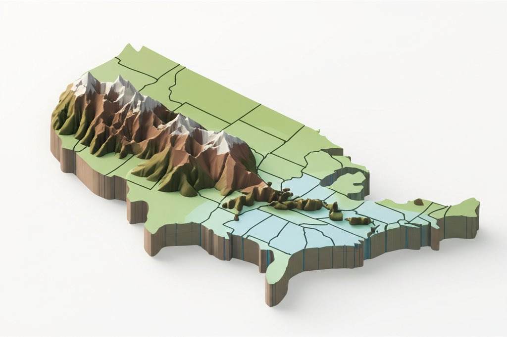
The United States isn’t just a nation; it’s a continent-spanning canvas painted with an astonishing array of natural wonders. From the sun-drenched beaches of Florida to the snow-capped Alaskan peaks, its diverse terrain shapes everything from weather patterns and ecosystems to cultural identities and economic activities. Understanding the US physical map is not merely an academic exercise; it’s the key to unlocking the story of America itself. This comprehensive guide will take you on an unparalleled journey across the United States geography, highlighting its majestic mountains, expansive plains, and intricate waterways, providing an in-depth look at what makes this land so unique and why a detailed physical map of US is an indispensable tool for comprehending its past, present, and future.
The Grand Tapestry of the US Physical Map: An Overview
The United States geography is a testament to millennia of geological forces, glacial movements, and climatic shifts. Imagine a vast landmass where plate tectonics have sculpted towering mountain ranges, ancient seas have deposited fertile plains, and relentless erosion has carved breathtaking canyons. This incredible diversity is what defines the US physical map, showcasing a dynamic interplay of landforms that profoundly impacts human settlement, agriculture, climate, and biodiversity.
Understanding the Major Physical Regions
To truly appreciate the physical map of US, it helps to delineate its primary physical regions. Broadly, these include:
- The Western Mountains (Cordillera): A complex system of ranges, including the Rocky Mountains, Sierra Nevada, Cascades, and Coastal Ranges, dominating the western third of the country.
- The Interior Plains: The vast, relatively flat heartland, home to the Great Plains, Interior Lowlands, and Central Lowlands, stretching from the Appalachians to the Rockies.
- The Appalachian Highlands: An older, more eroded mountain system on the eastern side, running parallel to the Atlantic coast.
- The Coastal Plains: Low-lying, fertile lands along the Atlantic and Gulf of Mexico shores.
- The Intermontane Plateaus and Basins: Arid and semi-arid regions nestled between the western mountains, like the Colorado Plateau and the Basin and Range Province.
- Alaska and Hawaii: Unique geographies with their own distinct volcanic and mountainous features.
Each region has its own geological story, unique climate, and specific ecological characteristics, contributing to the nation’s overall complexity and richness.
Why the US Physical Map Matters: Beyond Aesthetics
A detailed physical map of US is far more than just a pretty picture; it’s a critical foundational document. It helps us understand:
- Climate Zones: Mountain ranges create rain shadows, influencing precipitation. Coastal areas experience milder temperatures.
- Resource Distribution: The presence of fertile soils in the plains, mineral deposits in mountains, and freshwater in river basins directly relates to the underlying geography.
- Historical Development: Early settlement patterns, westward expansion, and the development of trade routes were heavily dictated by mountains, rivers, and plains.
- Ecological Hotspots: Specific landforms create unique habitats, fostering incredible biodiversity.
- Vulnerability to Natural Disasters: Coastal plains are susceptible to hurricanes; mountain regions face landslides and earthquakes.
By delving into these physical features, we gain a comprehensive understanding of the forces that have shaped and continue to shape the American landscape and its people.
For those seeking a deeper visual understanding and detailed representations of these regions, resources like the Gambara Maps available at LolaApp offer comprehensive and interactive physical maps of US, allowing for enhanced exploration and learning.
Towering Giants: Exploring the Mountain Ranges of US Geography
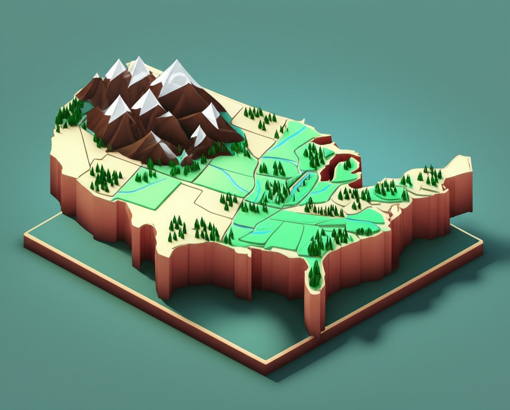
Mountains are the backbone of the United States geography, dramatically influencing everything from climate and river systems to population distribution and cultural identity. They stand as silent witnesses to immense geological forces, offering breathtaking vistas and crucial resources.
The Majestic Rocky Mountains: Formation, Features, and Impact
The Rocky Mountains are arguably the most iconic mountain range on the US physical map. Stretching over 3,000 miles from British Columbia in Canada down to New Mexico, this colossal system forms the continental divide, separating the flow of water eastward towards the Atlantic and Gulf of Mexico from westward flows towards the Pacific.
- Geological History: The Rocky Mountains were primarily formed during the Laramide Orogeny, a period of intense tectonic activity that began about 80 million years ago. Unlike many mountain ranges formed by direct plate collision, the Rockies resulted from a shallow subduction angle of the Farallon Plate, which caused crustal deformation far inland. This created a complex series of fault-block mountains, uplifted and folded sedimentary rocks, and volcanic intrusions.
- Key Features and Sub-ranges: Within the US, the Rockies encompass dozens of distinct ranges, each with its character. Notable examples include:
- The Front Range (Colorado): Home to iconic peaks like Longs Peak and Pikes Peak, forming a dramatic eastern wall.
- The Sangre de Cristo Mountains (Colorado/New Mexico): A narrow, rugged range known for its sharp peaks.
- The Teton Range (Wyoming): Famous for its jagged, glacier-carved peaks and the Grand Teton.
- The Wind River Range (Wyoming): Containing the highest point in Wyoming, Gannett Peak, and extensive glaciers.
- The Bitterroot Range (Montana/Idaho): Characterized by dense forests and high wilderness.
- Biodiversity and Ecosystems: The elevation changes in the Rocky Mountains create distinct life zones. Lower elevations boast ponderosa pine and Douglas fir forests, transitioning to subalpine fir and Engelmann spruce in mid-elevations. Above the treeline, alpine meadows burst with wildflowers in summer, giving way to barren rock and permanent snowfields. This array supports diverse wildlife, including elk, bighorn sheep, grizzly bears, and mountain lions.
- Climate Influence (Rain Shadow): The Rocky Mountains exert a powerful influence on climate. As moist air from the Pacific moves eastward, it’s forced upwards, cools, and releases precipitation on the western slopes (the windward side). By the time it descends the eastern slopes (the leeward side), the air is dry, creating a pronounced rain shadow effect that contributes to the arid conditions of the Great Plains and intermontane basins to the east.
- Economic Significance: The Rockies are a vital source of water for much of the western US, feeding major rivers like the Colorado and Rio Grande. Historically, they were rich in mineral deposits (gold, silver, copper). Today, tourism, recreation (skiing, hiking), and timber are major industries.
The Ancient Appalachians: A Story of Erosion and Resilience
Contrast the rugged youth of the Rockies with the ancient, rounded forms of the Appalachian Mountains on the eastern US physical map. This range, stretching from Newfoundland to Alabama, represents a much older geological story.
- Age and Erosion: The Appalachians formed even earlier than the Rockies, primarily during the Alleghenian Orogeny (around 300-250 million years ago), part of the collision that created the supercontinent Pangea. Millennia of erosion have smoothed their once-jagged peaks, creating rounded summits and deep, forested valleys.
- Highest Peaks and Sub-ranges: While not as towering as the Rockies, the Appalachians still boast impressive elevations, including Mount Mitchell in North Carolina (6,684 feet), the highest point east of the Mississippi. Key sub-ranges include:
- The Blue Ridge Mountains: Known for their distinctive blue haze and the scenic Blue Ridge Parkway.
- The Great Smoky Mountains: Famous for their biodiversity and ancient forests, part of the southern Appalachians.
- The Alleghenies and Cumberlands: Plateau-like regions in the central and northern Appalachians, rich in coal.
- Cultural and Historical Impact: The Appalachians historically acted as a significant barrier to westward expansion for early European settlers, shaping distinct regional cultures and fostering isolated communities. Today, they remain a source of coal, timber, and hydroelectric power, while attracting millions of tourists to national parks like the Great Smoky Mountains National Park.
Western Sentinels: Sierra Nevada, Cascades, and Coastal Ranges
Beyond the Rocky Mountains, the western United States geography is defined by another series of formidable ranges, each with its unique characteristics.
- Sierra Nevada: This magnificent fault-block mountain range in California and Nevada features towering granite peaks, including Mount Whitney (the highest point in the contiguous US at 14,505 feet). It’s famous for its giant sequoia forests (e.g., in Yosemite and Sequoia National Parks) and deep, glacier-carved valleys. Its western slopes receive abundant snow, crucial for California’s water supply.
- Cascades Range: Running from northern California through Oregon and Washington into British Columbia, the Cascades are a volcanic arc, part of the Pacific Ring of Fire. Dominant peaks like Mount Rainier, Mount Hood, and Mount St. Helens are active or dormant stratovolcanoes. They create a strong rain shadow, resulting in lush temperate rainforests on their western side and arid plateaus to the east.
- Coastal Ranges: Stretching along the Pacific coast, these lower, rugged mountains are characterized by dense forests, dramatic cliffs, and a climate heavily influenced by the Pacific Ocean, often shrouded in fog. They host unique ecosystems, including the iconic redwood forests.
Other Significant Mountain Systems
The US physical map also features other important mountain regions:
- Adirondack Mountains (New York): Part of the Canadian Shield, these ancient, heavily glaciated mountains are distinct from the Appalachians.
- Ozark Mountains (Ozark Plateau – Missouri, Arkansas, Oklahoma): A dissected plateau, more rugged and heavily forested than surrounding plains.
- Brooks Range (Alaska): A remote, east-west trending range in northern Alaska, part of the Arctic Cordillera.
- Hawaiian Islands: Volcanic peaks rising from the Pacific floor, with Mauna Kea and Mauna Loa being among the world’s largest mountains when measured from their base.
America’s Breadbasket and Beyond: The Expansive Plains and Plateaus
While mountains dominate the west and east, the vast central expanse of the US physical map is characterized by plains and plateaus, largely defining the agricultural and historical identity of the nation.
The Verdant Great Plains: Agriculture, Ecology, and Climate
The Great Plains are an immense, gently sloping grassland region stretching across the central United States geography, covering parts of 10 states. Often referred to as “America’s Breadbasket,” this region is vital to global food production.
- Size and Formation: Extending from the Rocky Mountains eastward to the Central Lowlands and from Canada to Texas, the Great Plains cover over 1.1 million square miles. They were formed largely by sedimentary deposits eroded from the Rockies and glacial till, resulting in relatively flat to gently rolling terrain.
- Fertile Soil and Agriculture: The defining characteristic of the Great Plains is its incredibly fertile soil, primarily deep, dark mollisols (chernozems) rich in organic matter. This, combined with a semi-arid to sub-humid climate and the development of irrigation techniques, has made it ideal for large-scale agriculture. Key crops include winter wheat, corn, and soybeans, while vast areas are dedicated to cattle ranching.
- Ecosystems: Historically, the Great Plains were dominated by two main prairie types:
- Tallgrass Prairie: Found in the wetter eastern portions, characterized by grasses that can grow several feet high. Much of this has been converted to agriculture.
- Shortgrass Prairie: Dominant in the drier western parts, closer to the Rockies, featuring shorter, drought-resistant grasses.
These prairies supported vast herds of bison and diverse wildlife.
- Historical and Climatic Significance: The Great Plains were home to numerous Native American tribes, including the Lakota, Cheyenne, and Comanche. European settlement, facilitated by railroads and new farming techniques, led to the transformation of the landscape. The region’s climate is characterized by extremes, with hot summers, cold winters, and frequent severe weather, including tornadoes. The infamous Dust Bowl of the 1930s highlighted the ecological vulnerability of the region when improper farming practices met sustained drought. Today, the strong winds across the plains make it a prime location for wind energy development.
The Arid Southwest: Colorado Plateau and Basin and Range Province
Southwest on the US physical map, the landscape transforms into arid and semi-arid plateaus and basins, showcasing dramatic geological formations.
- Colorado Plateau: This iconic region, spanning parts of four states (Utah, Colorado, Arizona, New Mexico), is a large, high desert area characterized by relatively flat-lying sedimentary rock layers that have been uplifted en masse. The most striking features are the deep canyons, mesas, and buttes, carved over millions of years by rivers like the Colorado River (creating the Grand Canyon) and relentless erosion. Its unique geology exposes billions of years of Earth’s history in vibrant, stratified rock.
- Basin and Range Province: To the west of the Colorado Plateau, this province covers Nevada, much of Utah, and parts of Arizona, New Mexico, and California. It’s defined by a series of parallel mountain ranges (the “ranges”) separated by arid valleys or down-dropped basins (the “basins”). This topography is a result of extensive crustal extension (stretching) over the last 30 million years. Death Valley, the lowest point in North America, is a classic example of a basin within this province, known for its extreme heat and salt flats.
Atlantic and Gulf Coastal Plains: Lowlands and Wetlands
The eastern and southern edges of the US physical map are defined by two significant coastal plains.
- Atlantic Coastal Plain: A low-lying, gently sloping plain extending from New England down to Florida. Formed by marine sediments deposited as ancient sea levels fluctuated, it features fertile soils, numerous estuaries, barrier islands, and some of the nation’s largest wetlands (e.g., the Great Dismal Swamp). It’s home to many major East Coast cities and agricultural areas.
- Gulf Coastal Plain: Extending around the Gulf of Mexico from Florida to Texas, this plain is characterized by even flatter terrain, extensive wetlands (including the vast Everglades in Florida), and the delta of the Mississippi River. It’s a region rich in oil and natural gas, but also highly vulnerable to hurricanes and sea-level rise.
Lifelines of the Land: Rivers, Lakes, and Waterways on the US Physical Map
Water bodies are the lifeblood of the United States geography, shaping ecosystems, enabling commerce, and profoundly influencing settlement patterns.
The Mighty Mississippi River System: Draining a Continent
The Mississippi River is the undisputed king of US waterways, and its entire system is a dominant feature on the US physical map.
- Length and Drainage Basin: While the Missouri River is technically longer, the Mississippi River system (Mississippi + Missouri) is the fourth-longest in the world. Its vast drainage basin covers over 1.2 million square miles, encompassing all or part of 31 states and two Canadian provinces, making it one of the largest watersheds globally.
- Role in History and Commerce: From Native American travel routes to a crucial artery for European exploration and settlement, the Mississippi has been central to American history. It facilitated trade, transported goods, and powered industry. Today, it remains a vital commercial waterway, supporting barge traffic and delivering goods to the port of New Orleans.
- Major Tributaries: Key tributaries include the Missouri River (the longest river in North America, draining much of the Great Plains), the Ohio River (draining the industrial heartland), and the Arkansas River.
- Delta and Ecosystems: The river culminates in a vast delta in Louisiana, a complex and dynamic ecosystem of wetlands, bayous, and barrier islands, vital for wildlife and the fishing industry, but also highly vulnerable to erosion and human impact.
The Great Lakes: Freshwater Giants of the North
On the northern US physical map, the Great Lakes stand as the largest group of freshwater lakes on Earth by total area and the second by volume.
- Formation: These five massive lakes (Superior, Michigan, Huron, Erie, Ontario) were carved and sculpted by continental glaciers during the last ice age, which retreated about 10,000 years ago, leaving behind massive depressions that filled with meltwater.
- Size and Significance: They hold about 21% of the world’s surface freshwater. They are crucial for shipping, providing a navigable route from the interior of North America to the Atlantic Ocean via the St. Lawrence Seaway. They support major industries, provide drinking water for millions, and significantly moderate regional climates.
- Ecosystems and Climate Influence: The lakes support diverse aquatic ecosystems and influence the climate of surrounding land, creating lake-effect snow in winter and tempering summer heat.
Western Rivers: Colorado, Columbia, and the Battle for Water
In the arid West, rivers are precious resources, heavily managed and often at the center of complex water politics.
- Colorado River: Carving through the Colorado Plateau and responsible for the Grand Canyon, this river is a lifeline for 40 million people across seven states. Its waters are extensively dammed (e.g., Hoover Dam, Glen Canyon Dam) to provide irrigation, hydropower, and drinking water, leading to significant challenges in resource allocation and environmental impact.
- Columbia River: Flowing from British Columbia through Washington and Oregon to the Pacific, the Columbia is the largest river by volume in the Pacific Northwest. It’s a major source of hydropower and historically supported vast salmon runs, though damming has significantly altered its ecosystem.
Inland Waterways & Aquifers
Beyond major rivers, a network of smaller rivers and vast underground aquifers also define the US physical map. The Ogallala Aquifer, for instance, underlies much of the Great Plains and is an irreplaceable source of irrigation water, though it is being depleted at an unsustainable rate. Understanding these hidden water resources is as crucial as mapping surface features.
Where Land Meets Sea: The Diverse US Coastlines and Islands
The US physical map is framed by thousands of miles of incredibly varied coastline, each segment telling a unique story of geological processes and oceanic influence.
Atlantic Coast: Bays, Beaches, and Barrier Islands
The Atlantic coast, stretching from Maine to Florida, presents a mix of geological features.
- Features and Currents: In the north, it’s characterized by rocky shores, fjords (e.g., in Maine), and numerous bays, a legacy of glacial erosion. Further south, the coastline transitions to sandy beaches, barrier islands (e.g., the Outer Banks of North Carolina), and vast estuaries like the Chesapeake Bay. The Gulf Stream, a warm ocean current, moderates the climate and influences marine life.
- Historical Significance and Ecosystems: This was the primary entry point for European colonization, and its natural harbors became major cities. The coastal wetlands and estuaries are critical nurseries for fish and shellfish, supporting rich biodiversity.
Gulf Coast: Wetlands, Deltas, and Hurricanes
The Gulf Coast, from Florida to Texas, is generally low-lying and dominated by sedimentary deposits.
- Mississippi Delta and Vulnerability: The Mississippi River’s immense delta creates a vast network of wetlands, essential for wildlife and flood control, but also rapidly eroding due to human activity and rising sea levels. The entire region is highly susceptible to severe weather, especially hurricanes, which frequently make landfall.
- Economic Importance: The Gulf of Mexico is a major center for offshore oil and gas production, as well as a significant fishing ground.
Pacific Coast: Rugged Cliffs, Fjords, and Tectonic Activity
The Pacific coast line, from Washington to California, is dramatically different, a testament to active tectonic forces.
- Tectonic Activity and Features: This coast is characterized by rugged cliffs, narrow beaches, and a mountain backdrop (Coastal Ranges, Cascades). It’s an active seismic zone with numerous faults, including the San Andreas. Further north, in the Puget Sound region of Washington and the Alaskan panhandle, glaciated fjords are prominent features.
- Climate and Ecosystems: The cold California Current cools the coast, contributing to the famous California fog. This region is home to unique ecosystems, including the dense redwood forests of Northern California and the rich marine ecosystems of its rocky shores.
Beyond the Mainland: Hawaiian Islands and Alaskan Archipelagos
The US physical map extends beyond the contiguous 48 states to include extraordinary island geographies.
- Hawaiian Islands: A chain of volcanic islands formed by a hotspot in the middle of the Pacific Plate. Each island represents a different stage of volcanic activity and erosion, from the active volcanoes of Hawaii (Big Island) to the deeply eroded canyons of Kauai. They boast unparalleled biodiversity and unique tropical ecosystems.
- Alaskan Archipelagos: Alaska features numerous island chains, including the Aleutian Islands, a volcanic arc that extends westward into the Bering Sea, and the Alexander Archipelago, a group of forested islands off the southeastern coast, characterized by fjords and temperate rainforests.
The Significance of Understanding US Physical Geography
A deep understanding of the United States geography is more than just knowing where things are; it’s about comprehending the intricate web of natural systems that define the nation and drive its future. The US physical map is a dynamic resource that provides critical insights for a multitude of fields.
Environmental Stewardship and Conservation
Geographical knowledge is fundamental to effective environmental stewardship. By understanding the distribution of ecosystems, the flow of water, and the vulnerability of specific landforms, environmental scientists can:
- Identify critical habitats: Protecting areas like the Everglades (Gulf Coastal Plain) or the ancient forests of the Sierra Nevada.
- Track environmental change: Monitoring glacier retreat in the Rocky Mountains or coastal erosion along the Atlantic seaboard.
- Develop conservation strategies: Designing protected areas, managing water resources, and restoring degraded landscapes.
Resource Management and Economic Development
The physical features of the US directly dictate the availability and accessibility of natural resources, impacting economic development.
- Agriculture: The fertile soils of the Great Plains underpin the nation’s agricultural sector.
- Energy: Mountainous regions offer hydropower potential, while the Gulf Coast is rich in fossil fuels. The windy plains are ideal for wind energy.
- Water Resources: Understanding river basins and aquifers is paramount for managing water supply for urban centers, industry, and agriculture, especially in arid regions of the West.
Climate Change and Future Challenges
The physical map of US provides a baseline for understanding the impacts of climate change and preparing for future challenges. Rising sea levels threaten coastal communities and wetlands; altered precipitation patterns impact water availability in the Rocky Mountains and Great Plains; and extreme weather events become more frequent. Geographical data is essential for modeling these changes and developing adaptation and mitigation strategies.
Cultural Identity and Recreation
The diverse landscapes of the US have profoundly shaped regional cultures and offer unparalleled opportunities for recreation. The rugged individualism associated with the West is intrinsically linked to the vastness of the Rocky Mountains and the Great Plains. The distinct cultural heritage of Appalachia emerged from its isolated valleys. From hiking in the Pacific Northwest Cascades to exploring the canyons of the Colorado Plateau, the United States geography inspires outdoor recreation, fostering a deep connection between people and nature.
Conclusion
The United States geography is an extraordinary tapestry of mountains, plains, rivers, and coastlines, each telling a story of Earth’s dynamic processes. From the sky-piercing peaks of the Rocky Mountains to the seemingly endless expanse of the Great Plains, and from the ancient Appalachians to the vibrant coastal wetlands, the US physical map is a testament to natural grandeur.
This detailed exploration of the nation’s physical features reveals not just their individual characteristics but also their profound interconnectedness, shaping climate, dictating resource distribution, influencing history, and inspiring generations. To truly understand America, one must first grasp the foundational power of its land. So, dive deeper, explore further, and let the magnificent physical map of US ignite your curiosity about the incredible world beneath our feet.
FAQ: Your Questions About the US Physical Map Answered
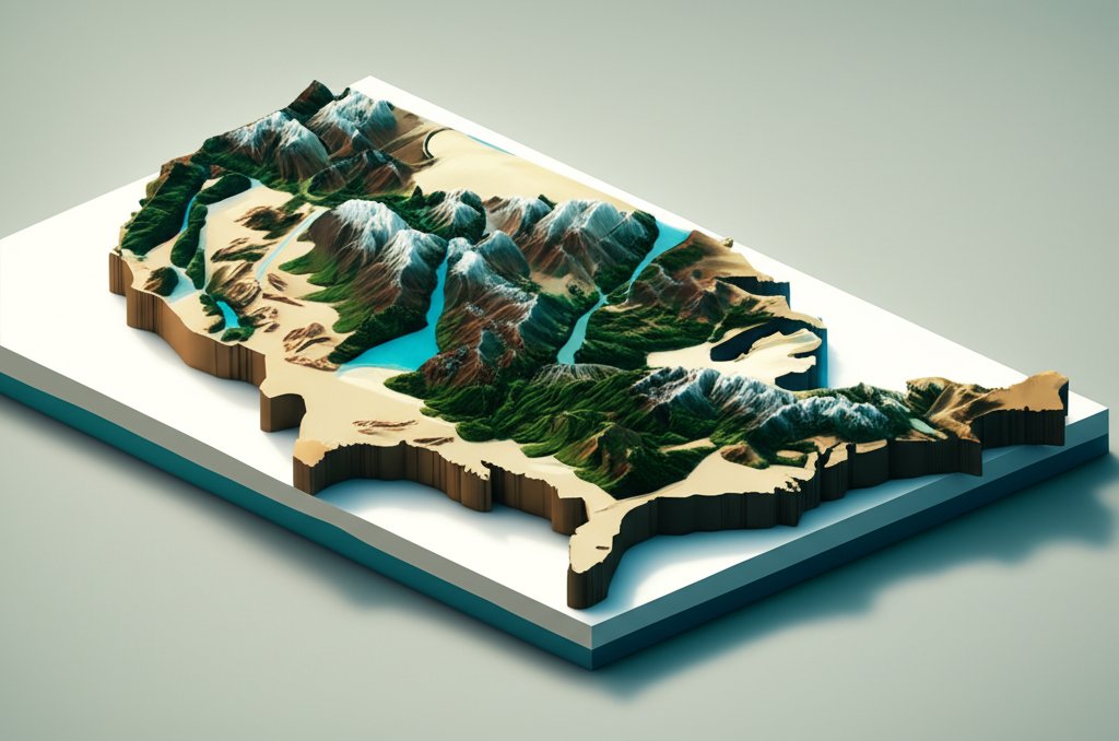
Q1: What are the major mountain ranges on the US physical map?
A1: The major mountain ranges on the US physical map include the Rocky Mountains (western US), Appalachian Mountains (eastern US), Sierra Nevada (California), Cascade Range (Pacific Northwest), and Coastal Ranges (along the Pacific).
Q2: Where are the Great Plains located and what are they known for?
A2: The Great Plains are located in the central United States geography, stretching from the Rocky Mountains eastward to the Central Lowlands. They are known as “America’s Breadbasket” due to their incredibly fertile soil and vast agricultural production (primarily wheat, corn, soybeans, and cattle).
Q3: What is the longest river in the US?
A3: The Missouri River is the longest river in the United States. When combined with the Mississippi River, it forms the fourth-longest river system in the world, playing a crucial role in the physical map of US by draining a vast portion of the continent.
Q4: How does the geography of the United States influence its climate?
A4: The United States geography significantly influences its climate in several ways:
Q5: What is the difference between a physical map of US and a political map?
A5: A physical map of US focuses on natural geographic features such as mountains, rivers, lakes, oceans, deserts, and elevations, often using color variations to denote topography. A political map, conversely, highlights human-made boundaries, including state borders, country lines, and the locations of cities and towns. Both are crucial for understanding the United States geography.
Q6: Which states are traversed by the Rocky Mountains?
A6: Within the contiguous United States, the Rocky Mountains traverse parts of New Mexico, Colorado, Wyoming, Utah, Idaho, and Montana.
Q7: What are some major features of the Colorado Plateau?
A7: The Colorado Plateau, a prominent feature on the US physical map, is known for its high elevation, arid climate, and dramatic erosional features. Its most famous features include the Grand Canyon, mesas, buttes, and deeply incised river canyons, showcasing vast layers of sedimentary rock.










