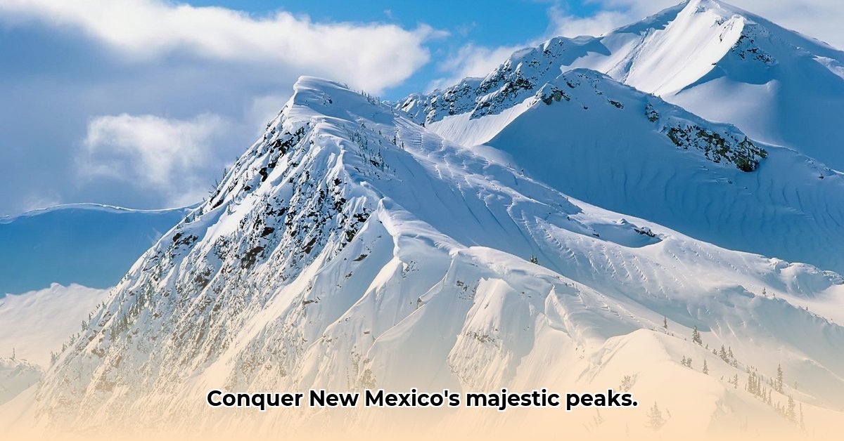
New Mexico’s mountains present a captivating landscape of towering peaks, serene valleys, and exhilarating trails, offering unforgettable adventures for seasoned hikers and novice explorers alike. This comprehensive guide unveils the secrets of these majestic landscapes, from conquering Wheeler Peak, the state’s highest point at 13,123 feet, to discovering breathtaking scenic drives. Essential tips for safe and responsible exploration are also included. For more detailed information, check out this New Mexico Mountains guide.
New Mexico Mountain Ranges: A Guide to Trails and Scenic Views
New Mexico’s diverse landscape showcases a dramatic collection of mountains, ascending majestically from the arid plains, creating diverse ecosystems that beckon adventurers to explore millions of years of geological history. These mountain ranges are more than just scenic backdrops; they are integral to the state’s identity.
Ascending to Great Heights: Exploring New Mexico’s Highest Peaks
Wheeler Peak, rising to 13,123 feet (4,000 meters), stands as New Mexico’s highest mountain, offering panoramic views. Sierra Blanca Peak, with its substantial prominence of 5,387 feet (1,642 meters), is another significant summit. Other notable high peaks include:
Truchas Peak: 13,107 feet (3,995 meters)
Mount Baldy: 12,441 feet (3,792 meters)
Lake Peak: 12,409 feet (3,782 meters)
Exploring these summits provides a connection with the state’s geological forces, inviting you to experience the mountainous terrain.
Geological Formation: Revealing the Stories Etched in Stone
New Mexico’s mountain ranges narrate millions of years of geological history, showcasing tectonic shifts, volcanic eruptions, and the sculpting power of wind and water. The Sangre de Cristo Mountains, a southern extension of the Rocky Mountains, display evidence of ancient glacial activity. The Sandia Mountains, near Albuquerque, reveal volcanic origins, with granite formations dating back over 1.4 billion years.
Key geological features include:
Fault-block mountains: Formed by the uplift and tilting of large crustal blocks.
Volcanic peaks: Remnants of past volcanic activity.
Sedimentary layers: Indicating periods of marine or fluvial deposition.
Each layer of rock and the shapes of the canyons whisper secrets of a dynamic past.
High Altitude Biodiversity: Exploring New Mexico’s High Altitude Ecosystems
The elevation gradients across New Mexico’s mountains generate diverse habitats, each harboring unique plant and animal life. Hardy alpine plants thrive at the highest elevations, while lower slopes are home to forests with ponderosa pines, Douglas firs, and aspens.
Examples of high-altitude species include:
Dwarf willow (Salix herbacea): A small, ground-hugging shrub found in alpine areas.
Bighorn sheep (Ovis canadensis): Adapted to steep, rocky terrain.
American pika (Ochotona princeps): A small mammal that lives in talus slopes.
Preserving this biodiversity is essential. These ecosystems require protection.
Discovering Trails: Hiking and Scenic Drives in New Mexico
New Mexico’s mountains offer trails and scenic drives for all skill levels.
Hiking Trails:
La Luz Trail (Sandia Mountains): A challenging climb to the summit of Sandia Peak.
Wheeler Peak Summit Trail: A strenuous hike to the highest point in New Mexico.
Nambe Lake Trail (Sangre de Cristo Mountains): A moderate hike to a beautiful alpine lake.
Scenic Drives:
Doc Long Scenic Byway (Sandia Mountains): Offers panoramic vistas and picnic areas.
Enchanted Circle Scenic Byway: A loop through the Sangre de Cristo Mountains, passing through towns like Taos and Red River.
High Road to Taos: A scenic route through the foothills of the Sangre de Cristo Mountains, with views of the Truchas Peaks.
Mountain Trip Checklist: Planning Your Ascent for Safety and Success
Planning is key to a rewarding mountain adventure. Take these steps to ensure a safe and fulfilling experience:
Trail Selection: Research trail difficulty, length, and elevation gain.
Weather Wisdom: Monitor weather forecasts, preparing for rapid changes. Mountain weather can change quickly.
Acclimatization: If coming from lower elevations, allow time to acclimatize to the altitude.
Leave No Trace: Remove all traces of your visit.
Preserving for the Future: Mountain Conservation Challenges and Opportunities
The increased popularity of New Mexico’s mountains presents opportunities and challenges, as visitor influxes strain delicate ecosystems. Sustainable tourism practices become crucial, balancing economic needs and environmental preservation.
Conservation efforts include:
Trail maintenance and restoration: Repairing damaged trails and preventing erosion.
Invasive species control: Removing non-native plants and animals.
Wildlife habitat protection: Conserving critical areas for wildlife.
Supporting ethical local organizations ensures preservation of these natural wonders.
Mountain Exploration Resources: Further Exploration
Continue your exploration of New Mexico’s mountains.
Resource
Description
New Mexico State Parks
Information on trails and facilities within mountain ranges.
US Forest Service
Details on national forests, wilderness areas, regulations, and trail maps.
Bureau of Land Management
Manages public lands, including mountain areas, with information on recreation opportunities.
Local Hiking Clubs
Guided hikes, local knowledge, trail reports, and conservation efforts.
Online Trail Mapping Sites
Detailed trail maps, reviews, elevation profiles, and user-contributed information.
New Mexico Geological Society
Provides information on the geology and natural history of New Mexico.
Responsible exploration ensures New Mexico’s mountains remain pristine and accessible. Lace up your boots, immerse yourself in the trails, and experience the magic of New Mexico’s high country!
Best Hiking Trails in New Mexico’s Less Known Mountain Ranges
New Mexico has many lesser-known mountain ranges that offer amazing hiking experiences catering to various skill levels. Exploring these hidden gems showcases New Mexico’s nature.
Key Highlights:
Explore New Mexico’s many lesser-known mountain ranges offering hiking experiences.
Discover trails catering to all skill levels.
Uncover New Mexico’s natural beauty.
The Sangre de Cristo Mountains: Venture Beyond the Beaten Path
Escape the crowds and venture deeper into the Sangre de Cristos. Hidden trails reveal alpine lakes and panoramic vistas, filled with wildlife and rugged peaks. These best hiking trails also provide solitude and scenery.
Recommended trails:
Pecos Baldy Lake Trail: A scenic hike to a high-altitude lake.
Lost Man Trail: Offers views of the Pecos Wilderness.
Lake Katherine Trail: Reaches the highest lake in New Mexico.
Guadalupe Mountains: Discover a Border Gem
Straddling the border between New Mexico and Texas, the Guadalupe Mountains offer a dramatic landscape of peaks and hidden canyons. This area is ideal for those searching for pristine wilderness.
Recommended trails:
Guadalupe Peak Trail: A strenuous climb to the highest point in Texas.
McKittrick Canyon Trail: A hike through a lush canyon with diverse plant life.
Devil’s Hall Trail: A unique hike through a narrow canyon with sculpted rock formations.
The Black Range: Exploring Remote Beauty and Dark Skies
The wild and rugged Black Range in southwestern New Mexico boasts forests, peaks, and canyons. Traverse ancient lava flows and forests, eventually reaching viewpoints. Its remoteness ensures solitude and nighttime views.
Recommended trails:
Emory Pass Trail: Offers views of the surrounding mountains.
Iron Creek Trail: A hike through a forested canyon.
Mogollon Trail: A long-distance trail through the heart of the Black Range.
Trip Planning: Essential Hiking Considerations
Trail Difficulty: Match trails to your ability level.
Trail Length & Elevation Gain: Plan for sufficient time, packing appropriately for variable weather.
Permits & Regulations: Follow regulations to protect landscapes. Check with the relevant land management agency (e.g., US Forest Service, Bureau of Land Management) for permit requirements.
Hello, My love for writing is rivaled only by my passion for in-depth research. While many may skim the surface, I dive deep, seeking the hidden gems of information that give a story texture and depth. Every word I write is backed by hours of exploration, ensuring that my work is not just compelling, but also meticulously accurate. Join me on a journey where every piece is a deep dive into the realms of knowledge and storytelling.