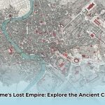
Ever dreamed of walking the ancient streets of Rome, witnessing the grandeur of the Colosseum in its prime, or observing a Senate debate unfold in the bustling Roman Forum? While a true time machine remains elusive, a meticulously crafted map of the ancient city of Rome offers an unparalleled portal to this remarkable past. Far beyond basic tourist guides, these cartographic tools, whether venerable hand-drawn parchment or sophisticated interactive digital simulations, provide unique and profound insights into how this powerful city grew, innovated, and profoundly shaped Western civilization. How precisely do these maps help us decode the enduring mysteries and epic scale of Rome’s lost empire?
From Republic to Empire: Rome’s Urban Transformation
Rome’s legendary growth from a modest Republic to a magnificent Empire was strikingly reflected in its evolving physical form. Its sophisticated urban design, essential public services, and formidable protective fortifications consistently adapted to meet the demands of its expanding influence. For instance, the Tiber River wasn’t merely a geographical feature; it served as Rome’s crucial lifeline, facilitating the transport of vital goods and people, fundamentally influencing early settlement patterns and economic activity.
- The Roman Forum functioned as the city’s vibrant heart, a bustling hub for commerce, profound political discourse, and crucial public announcements. Imagine the daily life unfolding there, thousands of years ago – senators debating, merchants bartering, and citizens gathering for news.
- The Colosseum and Circus Maximus were monumental structures dedicated to mass entertainment, drawing hundreds of thousands for gladiatorial contests and exhilarating chariot races. These venues were not just for leisure but served as powerful instruments of social cohesion and political control. The Circus Maximus, capable of holding over 250,000 spectators, truly embodied the scale of Roman public life.
- The city’s formidable walls, notably the early Servian Wall (dating from the 4th century BCE, though attributed to King Servius Tullius) and the later, more extensive Aurelian Walls (constructed between 271-275 CE), provided essential protection, safeguarding its inhabitants from external threats and defining its growing urban perimeter with impressive engineering.
Each of these elements played a pivotal role in shaping the unique character, strategic layout, and enduring legacy of the ancient city. Maps meticulously chronicled this evolution, providing a visual narrative of Rome’s relentless growth.
Navigating the Past: Types of Ancient Rome Maps
Not all maps are created equal, particularly when venturing into the distant past. So, what kind of map of the ancient city of Rome will guide your historical odyssey? Understanding the specific type of map fundamentally informs your interpretation and unlocks its unique insights.
Old-School Historical Maps: Treasured Artifacts and Scholarly Insights
These historical maps are true windows into past scholarship, meticulously crafted by distinguished cartographers and archaeologists. Scholars like S.B. Platner, whose detailed 1911 map significantly contributed to early 20th-century understanding, painstakingly produced these works. Such maps offer a direct glimpse into how experts understood Rome’s layout in their own era, often utilizing Latin nomenclature which reflects the prevailing academic and historical traditions of their creation. These artifacts are invaluable not only for studying ancient Rome itself but also for tracing the evolution of historical cartography and acknowledging the knowledge and inevitable biases of their time. They are, in essence, historical documents in their own right.
Modern Digital Maps: Accessibility, Interactivity, and Reconstruction
In stark contrast, modern digital maps offer unparalleled accessibility and dynamic interactivity. These sophisticated tools allow you to effortlessly zoom in on the ruins of long-lost temples, precisely trace the routes of ancient Roman roads, and even explore intricate 3D reconstructions of landmark buildings. This technological advancement has revolutionized how we engage with ancient history, transforming static images into immersive experiences. However, a crucial word of caution: despite their cutting-edge sophistication, digital maps can sometimes contain inaccuracies or interpretations based on incomplete archaeological data. Historians and archaeologists consistently advocate for cross-referencing them with original historical sources and recently updated findings to ensure full reliability. The interactive nature of these digital tools allows researchers to simulate ancient urban environments with greater precision than ever before, even projecting theories on how certain areas might have looked or functioned.
Here’s a concise comparison highlighting the distinct features of these two map types:
| Feature | Historical Maps | Digital Maps |
|---|---|---|
| Creation Method | Hand-drawn, based on arduous archaeological evidence, ancient texts, and limited surveys | Computer-generated, utilizing GIS (Geographic Information Systems), laser scanning, and diverse data sources |
| Language | Predominantly Latin, reflecting scholarly conventions of the time | Typically modern languages (English, Italian, etc.), with option for Latin overlay |
| Accessibility | Can be challenging to locate and access original prints or high-resolution scans | Readily accessible online and via specialized applications |
| Accuracy | Reflects the cumulative knowledge and inherent biases of a specific historical period | Can be highly accurate but necessitates cross-referencing; may include speculative reconstructions |
| Interactivity | Limited to visual interpretation and spatial reasoning | High; offers zooming, panning, layer overlays, 3D models, virtual walkthroughs, and data querying |
Decoding Rome: Key Landmarks Revealed by Maps
To truly feel as though you’re navigating the sprawling Roman Forum or envisioning the thrilling roar of the crowd at a gladiatorial contest, a detailed map of the ancient city of Rome functions as your personal, silent tour guide. These maps precisely highlight important buildings and structures, providing crucial clues about their original purpose, historical significance, and spatial relationships. For instance, did you know that the enduring mystery surrounding the exact origin of the Colosseum’s popular name “Colosseum” (likely from a colossal statue nearby) still sparks academic debate among scholars, rather than being its official ancient name (Flavian Amphitheater)? These visual aids are indispensable for piecing together the daily lives, grand spectacles, and monumental achievements of ancient Roman society.
Mastering Ancient Maps: Essential Tips for Interpretation
Ready to become proficient at interpreting ancient Roman maps and extracting every piece of historical data? Keep these essential tips in mind to significantly enhance your understanding and avoid potential misinterpretations:
- Consider the Map’s Chronology: A map drafted in the 19th century will naturally present a different perspective and level of detail, influenced by the archaeological knowledge available at the time, compared to a contemporary digital rendering incorporating the latest discoveries. Understanding its age and the context of its creation is fundamental. Maps from different eras reveal different stages of Roman construction and urban planning.
- Recognize Potential Bias and Purpose: Always remember that the mapmaker’s individual perspective, the prevailing knowledge of their era, and the explicit purpose of the map can subtly influence what information is included, emphasized, or even omitted. Was it a military campaign map, an administrative plan, or an artistic representation of imperial power?
- Implement Rigorous Cross-Referencing: To gain the most comprehensive and accurate understanding, always compare information gleaned from multiple maps with various historical sources, including ancient texts, modern archaeological reports, and scholarly analyses. This triangulation strategy significantly improves reliability and helps differentiate known facts from educated hypotheses.
Why Maps Matter: Unlocking Rome’s Enduring Legacy
In conclusion, delving into a map of the ancient city of Rome is akin to embarking on an extraordinary and enriching historical journey. These cartographic tools meticulously reveal the complex urban structure and sophisticated planning of one of history’s most influential civilizations. The intrinsic educational value of such content makes it invaluable for educators crafting engaging lessons, researchers unearthing new insights, tourists enriching their travel experiences, and general interest readers satisfying their curiosity. So, are you prepared to unravel the enduring mysteries of ancient Rome, one street, one building, one expertly crafted map at a time? This detailed exploration significantly enhances our appreciation for the remarkable ingenuity and foresight of Roman urban planning, a legacy that continues to resonate today.
Leveraging Maps: Who Benefits and How?
Different groups leverage ancient Roman maps for diverse, highly specific purposes, reflecting the maps’ versatile utility. Here’s a table illustrating how educators, heritage organizations, and tourists can effectively utilize these valuable resources, considering both immediate actions and long-term aspirations:
| User Group | Short-Term Actions (0-1 Year) | Long-Term Goals (3-5 Years) |
|---|---|---|
| Teachers/Researchers | Employ interactive digital maps to create more engaging lessons and facilitate critical comparison between digital and historical versions. Utilize maps for spatial analysis in research. | Collaborate to develop extensive, freely accessible online atlases of ancient Rome, integrated with the latest archaeological findings, comprehensive 3D models, and multi-layered data. Prioritize data security, accessibility, and open-source contributions. |
| Heritage Groups | Partner with leading map creators and archaeological institutions to guarantee cartographic accuracy and ensure responsible representation of historical sites for public education. Incorporate diverse cultural viewpoints into online exhibits. | Invest proactively in advanced LiDAR and photogrammetry technology for hyper-realistic virtual reconstructions of ancient Rome, continuously updating based on new research. Develop immersive virtual tours that allow exploration through various historical periods. |
| Tourists | Utilize digital maps for efficient visit planning and on-site navigation, but remain aware of potential inaccuracies or interpretive elements. Supplement use with scholarly guidebooks and articles for deeper historical insights. | Actively support efforts focused on the preservation and sustainable management of Roman monuments and archaeological sites. Promote ethical and responsible tourism practices that respect the city’s invaluable heritage and minimize environmental impact. |
The Cartographic Odyssey: How Roman Maps Evolved
Key Takeaways:
- Roman maps transitioned from humble, purely practical tools used for military and administrative needs to grand, artistic expressions of imperial power and cultural identity.
- Roman cartography skillfully blended established Greek geographical knowledge with their own pragmatic Roman priorities, focusing on utility over theoretical precision.
- This evolution is visibly represented in the shift from functional roadmaps (like the Tabula Peutingeriana) to monumental marble city plans (like the Forma Urbis Romae).
- Despite not always achieving modern geographical precision, Roman maps were fundamentally crucial for efficient urban development, sophisticated strategic planning, and effective imperial governance.
- Contemporary technologies, such as Geographic Information Systems (GIS) and digital surveying, draw direct inspiration from and build upon ancient Roman surveying techniques and organizational principles.
From Military Necessity to Imperial Grandeur
Imagine trying to effectively manage a vast, sprawling empire that at its zenith stretched from Britannia to Mesopotamia without the benefit of accurate, reliable maps. For the Romans, cartography transcended mere aesthetic appeal; it was an indispensable instrument for projecting power, maintaining control, and ensuring efficient logistical operations. How did Roman maps evolve from simple road layouts to elaborate displays of imperial grandeur? Initially, maps served intensely practical and utilitarian purposes. Considerations such as efficient troop movements, secure supply lines for legions, and the streamlined administration of newly conquered territories were paramount. These early Roman maps overtly prioritized functionality—showing how to get there and what was there—over strict modern geographic accuracy in terms of scale or projection. The art of agrimensura (land surveying), performed by professional agrimensores using tools like the groma (a cross-staff for squaring fields), was central to this practical approach.
The Tools of the Trade and the Art of Surveying
How exactly did the Romans manage to create these sophisticated maps? They employed an innovative combination of meticulous land surveying, precise road measurements often conducted by specialized mensores or even soldiers, and what we might today consider early forms of geographic information systems (GIS). These methodical techniques, often recorded on bronze tablets, papyrus, or painted on walls, enabled them to construct detailed depictions of their ever-expanding world. While pinpoint accuracy sometimes took a backseat to practicality (especially in areas where theoretical knowledge was limited), the overriding need for clear route information, precisely defined administrative boundaries, and visual representations of property ownership remained central to their cartographic endeavors. Julius Caesar, for instance, famously initiated a vast survey of the entire Roman world, though it was only completed by Augustus after decades of work. Agrippa’s grand Orbis Terrarum (Map of the World), publicly displayed in Rome, testified to the imperial ambition to map the known world.
A Tale of Two Maps: Tabula Peutingeriana vs. Forma Urbis Romae
To truly grasp the profound evolution and dual purpose of Roman cartography, consider two iconic examples that perfectly illustrate this trajectory from practical utility to symbolic representation.
- First, there’s the Tabula Peutingeriana: a remarkably long (6.8 meters or 22 feet), scroll-like roadmap dating back to the 4th century CE (though a medieval copy), which vividly showcases the extensive Roman road network. This map is less concerned with realistic shapes and proportional distances (e.g., the Mediterranean Sea is depicted as a narrow strip), primarily focusing instead on clearly depicting routes, identifying key settlements (indicated by symbols for cities, baths, etc.), and indicating distances between them. It’s a highly functional itinerary, designed for travelers and administrators.
- Then we have the Forma Urbis Romae: a monumental marble map of Rome itself, created impressively during the Severan dynasty between 203 and 211 CE. Originally measuring approximately 18 x 13 meters (60 x 43 feet) and affixed to a wall in the Temple of Peace, this wasn’t merely a navigational aid; it was an unprecedented, highly detailed plan of the city, depicting every building, street, and courtyard at an astonishing scale of approximately 1:240. It served as a grand, authoritative statement about the city’s intricate layout and the sheer scale of imperial power. Its primary purpose was administrative, likely for property registration or urban planning, but its public display also served as propaganda.
The Tabula Peutingeriana functions as a highly practical tool for long-distance travel, whereas the Forma Urbis Romae stands as a powerful symbol of Roman urban organization, meticulous planning, and profound imperial authority. Learn more about the Forma Urbis Romae and its significance.
Functionality Meets Symbolism: Roman Cartography’s Dual Purpose
Here’s where the interplay between immediate practical utility and grand symbolic representation becomes particularly intriguing. Roman cartography existed in a perpetual state of tension between immediate functional needs and grand symbolic expression. While meticulously detailed road networks were absolutely essential for effective governance, logistical support for the military, and the vast taxation system across the empire, maps simultaneously became powerful vehicles for conveying Roman dominance, celebrating the unparalleled grandeur of their civilization, and asserting their control over the known world (Orbis Terrarum). This inherent dual purpose is vividly evident in the harmonious blend of pragmatic and artistic elements consistently found in many Roman maps. They weren’t just showing you the way; they were eloquently narrating a compelling story about Rome’s power, its unparalleled achievements, and its paramount position in the ancient world.
Enduring Lessons for Contemporary Cartography and Planning
What enduring insights can we glean from these ancient mapping techniques? It turns out, quite a substantial amount. Modern archaeologists are presently employing advanced GIS technology, drawing direct inspiration from classical Roman surveying methods, to meticulously analyze historical urban development, reconstruct lost landscapes, and understand ancient land use patterns. Furthermore, educators are increasingly incorporating Roman maps and cartographic principles into diverse curricula, providing invaluable historical context to the entire field of cartography and demonstrating the long lineage of geographical thought. Urban planners, too, can extract profound insights from Roman urban design principles—such as the creation of grid plans for new colonies, the efficient management of water resources via aqueducts, and the strategic placement of public spaces—to inform and innovate contemporary city planning strategies. The principles of efficient layout, robust infrastructure, and social organization embedded in Roman urbanism remain surprisingly relevant for today’s growing metropolises.
| Feature | Roman Cartography (e.g., Tabula Peutingeriana) | Greek Cartography (e.g., Ptolemy’s Geography) |
|---|---|---|
| Primary Focus | Practical application, military logistics, administrative control, property documentation | Theoretical accuracy, mathematical projections, astronomical observations, philosophical understanding of the cosmos |
| Key Examples | Tabula Peutingeriana, Forma Urbis Romae, military road maps, provincial administrative maps | Ptolemy’s Geography, Anaximander’s world map, Eratosthenes’s calculation of Earth’s circumference |
| Emphasis | Functional routes, settlements, political boundaries, urban layouts | Latitude, longitude, precise measurements, geometric representations |
| Overall Approach | Pragmatic Utility, empirical observation, direct experience | Mathematical Precision, theoretical models, philosophical inquiry |
A Lasting Legacy: Maps as Mirrors of Civilization
So, the next time you consult a map, take a moment to reflect on the Romans. Their innovative approach to cartography, while distinct from our highly sophisticated modern methods involving satellite imagery and digital databases, undeniably laid fundamental groundwork for many of the mapping techniques and principles we utilize every day. They powerfully demonstrate that a map is never merely a map; it is an intricate reflection of the society, its prevailing values, its technological capabilities, and its understanding of the world that brought it into existence. Roman maps meticulously captured not only geographical realities but also their ambitious aspirations, core values, and comprehensive understanding of the expansive world around them. It is an enduring legacy that continues to profoundly shape how we perceive and interact with our own contemporary world, a testament to the fact that mapping is fundamentally a human endeavor to organize and comprehend space.
Essential Landmarks: Navigating Ancient Rome’s Historic Heart
Key Takeaways:
- Ancient Rome’s enduring allure stems from its rich blend of founding myths, groundbreaking architectural innovations, and profound, lasting impact on Western civilization.
- The city remarkably evolved from a burgeoning Republic into a vast Empire, fundamentally shaping its distinct urban form and leaving an indelible architectural legacy meticulously recorded on its maps.
- Iconic landmarks like the Roman Forum, Palatine Hill, Colosseum, and Pantheon vividly showcase quintessential Roman daily life, unparalleled engineering ingenuity, and the sheer scale of imperial power.
- Both historical and contemporary maps are invaluable tools that help us meticulously trace Rome’s remarkable growth, understand its complex historical stratification, and precisely locate its key sites.
- Interpreting these maps facilitates a deeper appreciation for Rome’s transformative changes, its sophisticated urban planning, and its enduring global influence, offering a multi-layered view of its past.
Imagine holding a map that effectively unlocks the profound secrets of ancient Rome, a vibrant city once teeming with intense life, immense power, and relentless innovation. These maps, encompassing both venerable historical documents and cutting-edge modern iterations, are far more than mere lines on paper; they are actual portals to a bygone world that profoundly shaped our own present. So, what Essential Landmarks Shown On Ancient Rome Map truly helped define this magnificent and influential city, and how do maps illuminate their significance? Let’s explore.
The Roman Forum and Palatine Hill: The Political and Elite Heart of Rome
Have you ever wondered where the very pulse of Rome’s political, social, and religious life vibrated most intensely? Look no further than the iconic Roman Forum and the majestic Palatine Hill. The Forum served as the city’s undeniable bustling center, meticulously housing pivotal government buildings (like the Curia, the Senate House), sacred temples (such as the Temple of Saturn and the Temple of Vesta), and vital public spaces. Can you vividly imagine the passionate debates echoing through the halls, or the daily clamor of citizens engaging in commerce or seeking legal counsel? Maps from different periods show the Forum’s evolution, from early republican simplicity to the grand imperial additions.
Nearby, the elevated Palatine Hill offered breathtaking panoramic views and served as the exclusive residential area for Rome’s elite, including emperors from Augustus onward. The ruins of the Domus Augustana (part of Domitian’s palace) and the Domus Tiberiana (Palace of Tiberius) on the Palatine are prominently featured on detailed maps, revealing the vastness of imperial residences. Aren’t you curious about the day-to-day existence of those ancient inhabitants, their opulent villas and private gardens, all located strategically above the city’s administrative heart? Together, these intertwined sites offer a fascinating and comprehensive glimpse into the daily lives and complex societal evolution of the ancient Romans, with maps serving as crucial guides to their layout.
Aqueducts: Engineering Marvels Supplying Imperial Life
How did ancient Rome, a city that grew to over a million inhabitants at its peak (primarily of the slave and plebeian classes), manage to successfully quench its widespread thirst and maintain public hygiene? The ingenious answer lies in its truly remarkable aqueducts. These colossal engineering marvels, such as those prominently showcased within the sprawling Park of the Aqueducts (east of the city center), powerfully demonstrate the Romans’ unparalleled ingenuity in overcoming significant geographical and logistical challenges. Nineteen major aqueducts supplied Rome with over a million cubic meters (300 million gallons) of fresh water daily from various distant sources. They guaranteed a consistent and reliable water supply for the city’s lavish public baths, fountains, and private homes, thereby dramatically improving the quality of life for countless citizens throughout the city. Maps often depict these vital arteries, tracing their winding paths from distant hills into the urban core. Isn’t it astounding how they masterfully engineered such complex systems, enduring for centuries and influencing urban infrastructure even today?
The Colosseum: A Stage for Spectacle and Power
Can you vividly picture the thunderous


