# Unlock Green Energy Potential: A Comprehensive Guide to Energy Mapping
Harnessing the full potential of green energy requires strategic planning and informed decision-making. This guide provides a comprehensive overview of energy mapping techniques, focusing on identifying optimal locations for renewable energy projects. We'll explore established methodologies, delve into emerging concepts like ley lines, and equip you with the knowledge to maximize your green energy investments. For a regional example, see this [Southeast US map](https://www.lolaapp.com/map-of-southeast-us/).
## Energy Mapping: A Strategic Approach to Green Power Generation
The transition to renewable energy sources is accelerating, making efficient site selection crucial. Energy mapping provides a framework for analyzing geographical data, resource availability, and potential challenges to identify the most promising locations for solar, wind, and other renewable energy projects.
### Mapping Renewable Resources: Data-Driven Insights for Optimal Locations
Accurate and reliable data is the foundation of effective energy mapping. Government agencies and research institutions provide a wealth of information on renewable energy resources, including solar irradiance, wind speeds, geothermal potential, and biomass availability. These datasets are commonly presented in map formats, enabling users to visualize resource distribution and identify areas with high potential.
* **Solar Resource Maps:** These maps illustrate the amount of solar radiation received in different locations, typically measured in kilowatt-hours per square meter per day (kWh/m²/day). They consider factors like latitude, altitude, cloud cover, and atmospheric conditions.
* **Wind Resource Maps:** Wind maps depict average wind speeds at different heights above ground level. They are crucial for identifying suitable locations for wind turbines, taking into account terrain, obstacles, and wind patterns.
* **Geothermal Resource Maps:** These maps highlight areas with geothermal potential, indicating the temperature and depth of geothermal reservoirs. They are essential for developing geothermal power plants and direct-use applications.
* **Biomass Resource Maps:** Biomass maps show the distribution and availability of biomass resources, such as agricultural residues, forestry products, and dedicated energy crops. They are used to assess the feasibility of biomass-based energy production.
### Integrating Data Layers: A Holistic View of Energy Potential
Effective energy mapping goes beyond visualizing individual resource datasets. Geographic Information Systems (GIS) provide the tools to integrate multiple data layers, creating a comprehensive view of energy potential. This process allows for the identification of locations that meet specific criteria, such as proximity to transmission lines, suitable land use, and minimal environmental impact.
GIS platforms enable analysts to:
* Overlay resource maps with infrastructure data (roads, power lines, substations).
* Analyze land use patterns and identify areas suitable for renewable energy development.
* Assess environmental constraints (protected areas, sensitive habitats, water resources).
* Model energy production and estimate economic feasibility.
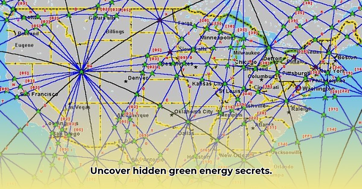
### The Enigmatic Ley Lines: Exploring Earth Energy Pathways
Ley lines represent a controversial and less understood aspect of energy mapping. These are hypothetical alignments of ancient sites, natural landmarks, and geographical features, theorized to represent energy pathways or spiritual connections. While scientific evidence for ley lines remains limited, some researchers and practitioners explore their potential influence on energy flows and environmental conditions.
Integrating ley line data into energy mapping involves:
* **Data Collection:** Gathering information on ley line locations from historical maps, archaeological records, and alternative sources.
* **GIS Integration:** Overlaying ley line data with renewable energy resource maps and other relevant datasets.
* **Spatial Analysis:** Investigating potential correlations between ley line alignments and areas with high renewable energy potential.
It's essential to approach ley line analysis with caution, acknowledging the lack of scientific validation and avoiding unsubstantiated claims. However, exploring unconventional perspectives can sometimes lead to unexpected insights and innovative approaches to energy mapping.
### Stakeholder Engagement: Collaborative Planning for Sustainable Energy Development
Effective energy mapping requires collaboration among various stakeholders, including renewable energy developers, government agencies, researchers, landowners, and community members. Engaging stakeholders throughout the mapping process ensures that diverse perspectives are considered, and that project decisions align with local needs and priorities.
Here's how different stakeholders can leverage energy mapping:
* **Renewable Energy Developers:** Identify optimal locations for renewable energy projects, assess resource availability, and mitigate potential risks.
* **Government Agencies:** Develop energy policies, plan infrastructure investments, and promote sustainable energy development.
* **Researchers:** Conduct data-driven analyses, explore emerging energy technologies, and evaluate the impact of energy projects on the environment and society.
* **Landowners:** Assess the potential for renewable energy development on their property, diversify income streams, and contribute to a sustainable energy future.
* **Community Members:** Participate in project planning, voice concerns, and ensure that renewable energy projects benefit local communities.
### Risk Mitigation: Addressing Challenges and Uncertainties
Developing renewable energy projects involves various risks and uncertainties, including regulatory hurdles, technical challenges, environmental impacts, and community opposition. Energy mapping can help mitigate these risks by identifying potential problems early in the planning process and developing strategies to address them.
| Risk Factor | Likelihood | Impact | Mitigation Strategies |
| --------------------------- | ---------- | --------- | -------------------------------------------------------------------------------------------------------------------------------------------------------------------------------------------------------------------------- |
| Regulatory hurdles | Medium | High | Conduct thorough regulatory reviews, engage government agencies early in the process, and address potential concerns proactively. |
| Intermittent energy supply | High | Medium | Diversify energy sources, implement energy storage solutions (e.g., batteries, pumped hydro), and integrate renewable energy with existing grid infrastructure. |
| Environmental impact | Medium | Medium | Conduct comprehensive environmental impact assessments, implement mitigation measures (e.g., habitat restoration, noise reduction), and adhere to environmental regulations. |
| Technological changes | Low | High | Stay updated on emerging technologies, design adaptable projects, and invest in research and development. |
| Conflicts over land use | Medium | Low | Engage local communities, conduct public consultations, address concerns about visual impacts and noise pollution, and provide economic benefits to local residents. |
| Grid connection constraints | Medium | High | Assess grid capacity, identify potential bottlenecks, work with utilities to upgrade grid infrastructure, and explore distributed generation options. |
| Financing challenges | Medium | Medium | Develop strong financial models, secure government incentives, attract private investors, and explore innovative financing mechanisms (e.g., green bonds). |
| Supply chain disruptions | Low | Medium | Diversify supply chains, establish long-term contracts with suppliers, and invest in domestic manufacturing capacity. |
| Extreme weather events | Medium | Medium | Design resilient infrastructure, implement disaster preparedness plans, and consider climate change projections in project planning. |
### Enhancing Renewable Energy Site Selection with GIS and Ley Line Analysis
Integrating ley line analysis into GIS-based renewable energy site selection can offer a unique and potentially insightful perspective, despite the lack of widespread scientific validation. This approach combines conventional GIS techniques with the exploration of unconventional data to identify potential correlations and optimize site selection.
### Integrating Ley Line Analysis: A Step-by-Step Approach
1. **Data Acquisition:** Gather data on proposed ley line locations from various sources, including historical maps, archaeological studies, and alternative research. Critically assess the reliability and accuracy of these sources.
2. **GIS Integration:** Import the ley line data into a GIS platform (e.g., ArcGIS, QGIS). Overlay these data points with traditional renewable energy site assessment datasets, such as topography, wind data, solar irradiance, and grid infrastructure.
3. **Spatial Analysis:** Utilize GIS tools to analyze the spatial relationships between ley lines and renewable energy resource potential. Conduct proximity analysis to determine how close potential sites are to ley lines. Overlay different data layers to identify areas where ley lines intersect with high-resource potential.
4. **Multi-Criteria Decision Analysis (MCDA):** Incorporate the spatial analysis results into an MCDA framework. This allows for a systematic weighting of different factors, including proximity to ley lines, to create a comprehensive site suitability map. Assign a conservative weight to the ley line data, reflecting its uncertain nature.
5. **Sensitivity Analysis:** Conduct a sensitivity analysis to evaluate the influence of ley line data on the overall site ranking. This helps determine the impact of this unconventional factor on your final results and assess the robustness of your analysis.
### Limitations and Cautions
This integrated approach requires careful consideration of the limitations and uncertainties associated with ley line analysis. It's crucial to acknowledge the lack of scientific evidence supporting the existence and influence of ley lines.
* **Avoid Overstating Potential Correlations:** Carefully qualify observations and avoid making unsubstantiated claims about the relationship between ley lines and renewable energy potential.
* **Use as a Supplementary Tool:** Emphasize the use of ley line analysis as a supplementary tool rather than a primary selection criterion.
* **Maintain Scientific Rigor:** Ensure that your analysis is grounded in sound scientific principles and data analysis techniques.
### Conclusion: A Balanced Approach for Sustainable Energy Development
Energy mapping provides a powerful framework for identifying optimal locations for renewable energy projects and promoting a sustainable energy future. By integrating diverse data sources, engaging stakeholders, and mitigating potential risks, we can harness the full potential of green energy and build a cleaner, more resilient planet. While the incorporation of ley line analysis remains speculative, it encourages exploration and innovation within a framework of scientific rigor.
Hello, My love for writing is rivaled only by my passion for in-depth research. While many may skim the surface, I dive deep, seeking the hidden gems of information that give a story texture and depth. Every word I write is backed by hours of exploration, ensuring that my work is not just compelling, but also meticulously accurate. Join me on a journey where every piece is a deep dive into the realms of knowledge and storytelling.