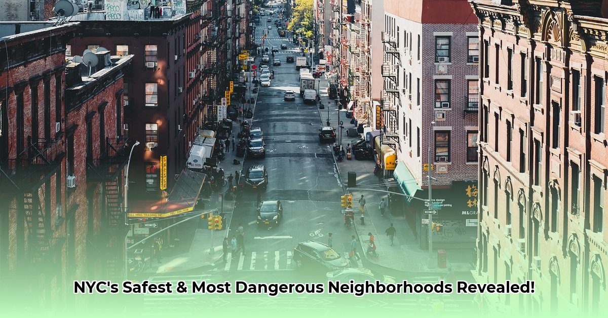
New York City, a global hub of culture and commerce, presents both excitement and challenges, including variations in neighborhood safety. This guide aims to provide an informed perspective on areas consistently identified as having higher crime rates, empowering you to make smart and safe choices. We’ll explore neighborhoods like Brownsville, Hunts Point, Mott Haven, East Harlem, and Bedford-Stuyvesant, examining crime types and underlying factors. We’ll also address the nuances of crime data, including source limitations and contributing socio-economic factors, emphasizing community-driven efforts to enhance safety. This isn’t about instilling fear; it’s about equipping you with actionable intelligence to navigate NYC confidently. For a visual representation of NYC neighborhoods, check out this helpful NYC Map.
Understanding NYC Safety: Analyzing High-Crime Areas and Actionable Advice
Navigating New York City requires understanding its complexities, including areas with higher crime rates. This guide focuses on informed decision-making. Certain neighborhoods consistently appear on “high-crime” lists, but the statistics require careful interpretation. Let’s examine a clearer picture of neighborhood crime in order to foster safety.
High-Crime Neighborhoods: A Closer Look
Certain areas of NYC statistically experience more crime than others. Brownsville, Hunts Point, Mott Haven, East Harlem, and Bedford-Stuyvesant are frequently mentioned in these discussions regarding safety. These neighborhoods often see higher instances of violent crimes like assault and robbery, along with significant property crime. However, it’s crucial to acknowledge that crime statistics vary depending on the source and the time period studied. As such, it is important to see the safety of these areas through a critical, data-informed lens.
Delving deeper, it’s important to recognize that these neighborhoods are not monolithic entities. Each possesses its own unique characteristics, demographics, and micro-climates of criminal activity. For instance, while Brownsville might grapple with higher rates of gang-related violence, Hunts Point could be more impacted by drug-related offenses and prostitution. Understanding these nuances is crucial for a nuanced understanding of safety levels.
Furthermore, the perception of safety can be significantly different from the reality reflected in crime statistics. Factors such as community engagement, visible police presence, and even the time of day can dramatically influence an individual’s sense of security in a particular neighborhood. It is therefore important to consider both objective data and subjective experiences when assessing neighborhood safety.
Understanding the Numbers: Data Sources and Their Limitations
The information presented comes from various online sources, including publicly available data reports. Each source uses its own unique methods for collecting and analyzing crime data. This means the exact numbers and rankings might differ slightly from one source to another further emphasizing how you must be aware of data collection discrepancies when approaching safety in NYC. Some sources might emphasize specific types of crime, like burglaries, while others focus on violent crimes. They aren’t a perfect measure of a neighborhood’s overall safety.
Several key sources provide crime data for NYC, including the New York City Police Department (NYPD), the Federal Bureau of Investigation (FBI), and independent research organizations like the Brennan Center for Justice. The NYPD’s CompStat system offers detailed, precinct-level data on reported crimes, while the FBI’s Uniform Crime Reporting (UCR) program provides standardized national crime statistics. However, each of these sources has its limitations. CompStat data may be subject to manipulation or underreporting, while the UCR relies on voluntary reporting from law enforcement agencies, which can lead to inconsistencies.
Moreover, crime statistics often fail to capture the full extent of criminal activity in a neighborhood. Many crimes go unreported due to fear of retaliation, distrust of law enforcement, or a belief that the police will not be able to solve the crime. This “dark figure of crime” can significantly skew our understanding of neighborhood safety.
The Roots of Crime: Socioeconomic Factors and Seasonal Variations
Why do some neighborhoods experience higher crime rates? It’s a complex issue with several interconnected factors. Socioeconomic conditions play a significant role; and factors like poverty and seasonal changes can also influence crime rates affecting neighborhood safety. Understanding these complex factors is crucial for creating effective solutions.
The relationship between socioeconomic conditions and crime rates is well-established. Poverty, unemployment, lack of access to education and healthcare, and housing instability can all contribute to higher levels of crime in a neighborhood. These factors create a cycle of disadvantage that can be difficult to break.
For example, a lack of job opportunities can lead to increased rates of property crime, as individuals turn to theft to make ends meet. Similarly, inadequate access to mental health services can exacerbate violent crime, as individuals with untreated mental illnesses are more likely to engage in criminal behavior. The presence of gangs and drug trafficking networks can also contribute to higher crime rates, as these organizations often prey on vulnerable populations and exploit existing social problems.
In addition to socioeconomic factors, seasonal variations can also influence crime rates. Crime rates tend to be higher in the summer months, when more people are outdoors and there is increased opportunity for criminal activity. Tourism can also impact crime rates, as popular tourist destinations often experience higher rates of theft and pickpocketing.
Staying Safe in NYC: Practical Advice
Here’s some practical advice tailored to different groups:
- For Residents of High-Crime Areas: Advocate for better streetlights and lighting. Strengthen community watch groups by watching out for fellow neighbors. Support local anti-crime initiatives, and advocate for long-term community development.
- For Tourists: It’s safer to use ride-sharing services, especially at night, rather than walking alone in unfamiliar areas. Avoid poorly lit areas after dark, and be aware of your surroundings to avoid theft. Don’t flaunt expensive items.
- For the NYPD: Increase police presence in high-crime areas to deter crime. Analyze crime data to target specific crime types. Foster collaboration with local communities and invest in community-based crime prevention programs that address the underlying causes of crime.
- For the City Government: Fund crime prevention programs to address long-term crime. Improve infrastructure by upgrading streetlights and public transportation, and expand access to social services. Implement urban renewal projects that create opportunity.
Expanding on this advice:
- Residents: Actively participate in community meetings, voice your concerns to local officials, and support organizations that provide job training, educational opportunities, and social services to residents.
- Tourists: Research your destination beforehand, stick to well-travelled routes, and be aware of common tourist scams. Consider taking a guided tour to learn more about the neighborhood and its history.
- NYPD: Implement community policing strategies that focus on building relationships with residents and addressing their specific concerns. Utilize data-driven approaches to identify crime hotspots and allocate resources effectively. Prioritize de-escalation techniques and training to reduce the risk of police brutality and misconduct.
- City Government: Invest in affordable housing, improve public schools, and create job training programs that provide residents with the skills they need to succeed in the workforce. Implement policies that promote racial and economic equity.
The Bigger Picture: Community Well-being and Ongoing Research
Defining the “most dangerous” parts of NYC is just one aspect of a larger conversation. A collaborative effort from residents, law enforcement, and city officials is needed, working together toward safer and more vibrant communities. The path to safer neighborhoods is an ongoing journey, also requiring research that refines our understanding of these complex issues.
Beyond crime statistics, it’s essential to consider the overall well-being of a community. Factors such as access to healthcare, quality of education, availability of green spaces, and levels of social cohesion all contribute to a neighborhood’s overall health and safety. Addressing these issues requires a holistic approach that involves multiple stakeholders and recognizes the interconnectedness of social, economic, and environmental factors.
Ongoing research is also crucial for understanding the complex dynamics of crime and developing effective prevention strategies. This research should focus on identifying the root causes of crime, evaluating the effectiveness of different interventions, and developing innovative solutions that address the unique challenges faced by each neighborhood. By investing in community well-being and supporting ongoing research, we can create safer, healthier, and more vibrant communities for all New Yorkers.
How to Compare NYC Neighborhood Safety Data from Multiple Sources
Key Takeaways:
- NYC crime rates aren’t uniform; some areas have far higher crime rates than others.
- Sources disagree on the precise ranking of “most dangerous” neighborhoods due to differing methodologies and data.
- Socioeconomic factors heavily influence crime rates.
High-Crime Neighborhoods: Understanding the Nuances of Safety Levels
Several NYC neighborhoods consistently appear in discussions about high crime rates. These include Brownsville, Hunts Point, Mott Haven, East Harlem, and Bedford-Stuyvesant; but what does that really mean? Understanding the nuances is key to understanding safety levels. Crime statistics don’t tell the whole story. For example, one source might prioritize violent crimes over property crimes; another might focus on per capita rates, while another on total incidents. This is crucial when you’re trying to compare NYC neighborhood safety data from multiple sources.
Each neighborhood has its own unique character and challenges. In Brownsville, for instance, you might find a higher concentration of certain types of crime compared to Hunts Point, even if their overall crime rates appear similar. There’s no single, simple answer in approaching the safety levels of neighborhoods.
Consider, for example, the impact of gentrification on crime rates. As neighborhoods like Bedford-Stuyvesant undergo revitalization, they may experience a decrease in certain types of crime, but also an increase in others, such as property crime targeting new residents. These dynamics are often missed when relying solely on aggregate crime statistics.


